Now You See Me, Now You Don’t
Now You See Me, Now You Don’t
Langston Sanchez
2015, 11 min
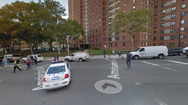
Now You See Me, Now You Don’t tells the visual story of how policing appears in Google Maps Street View. Google Maps is generally used for getting directions, determining travel time, and finding landmarks. Google Street View provides users with an interactive panorama view of the street. This interactive panorama is made up of images that are stitched together. This stitching causes inconsistencies in the Street View panorama. These inconsistencies could be called glitches both in systems of surveillance and policing. These glitches when investigated show the consistent nature of policing in the particular sites around 125th Street and Amsterdam Avenue in New York City.